The Prophet's biography, mapped
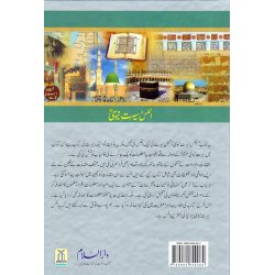
Reading the seerah is one thing; seeing where each journey, battle, and treaty actually took place on the map of Arabia is another — and it is often the missing piece that turns a list of names and places into a coherent picture. Atlas Seerat An-Nabi (اطلس سیرت النبی) — "Atlas of the Prophet's Biography" rounds up a full series of full-color maps compiled in a single, consistent format to track the Prophet Muhammad's ﷺ life: the places he visited and honored, the battles he fought, and the expeditions and envoys he directed.
What the atlas provides
Every map is paired with the required illustrations, drawings, and photographs, plus concise briefings and excerpts placed alongside the visuals so a reader gains real understanding and benefit from each image rather than a picture without context. The result functions as a geographic companion to any full seerah text — Ar-Raheeq Al-Makhtum, Zad al-Ma'ad, or a classical biography — rather than a replacement for one.
Who benefits most
Students, teachers preparing a seerah course, and any reader who wants to visualize the Hijrah route, the sites of Badr and Uhud, and the geography of the Prophet's ﷺ mission will find this atlas fills a gap that text alone cannot.
Related Reading
Pair this atlas with Urdu: Atlas of Quran and Urdu: Atlas Futuhatay Islamiyah to build a complete visual reference shelf.
اردو تعارف
یہ کتاب اٹلس کی ایک سیریز کو جمع کرتی ہے، جسے مصنف نے اسی طرز پر لکھا اور مرتب کیا ہے۔ اس میں رسول اللہ صلی اللہ علیہ وسلم کی سیرت کا جائزہ لیا گیا ہے اور ان مقامات کا سراغ لگایا گیا ہے جن کو آپ نے اپنے دوروں سے نوازا، آپ نے جو لڑائیاں لڑیں، اور جن مہمات اور سفیروں کی ہدایت کی۔ کتاب تمام مطلوبہ نقشے، عکاسی، ڈرائنگ اور تصاویر پیش کرتی ہے۔ تصویروں اور ڈرائنگ میں بریفنگ اور اقتباسات شامل کیے گئے ہیں تاکہ قارئین کی بہتر تفہیم، فائدہ اور اطمینان ہو۔



 (2)
(2)